
Del 6
The Tithe Maps of England and Wales
A Cartographic Analysis and County-by-County Catalogue
Inbunden, Engelska, 1995
5 109 kr
Beställningsvara. Skickas inom 7-10 vardagar. Fri frakt för medlemmar vid köp för minst 249 kr.
Finns i fler format (1)
The tithe surveys of mid-nineteenth-century England and Wales marked a new departure in government-sponsored, cadastral surveying of the nation's land. The 11,800 large-scale, detailed maps which they comprise are recognised as one of the most important sets of manuscript historical sources used by historical geographers and economic, social and local historians as well as lawyers representing clients in property and rights of way disputes and county and local planning offices. Despite this much acknowledged value, historians are not well served with indexes, descriptive catalogues or indications of tithe map coverage. A first object of this book is to provide a standard work of reference which will be an essential research tool for users of tithe maps. The database has also been analysed to reveal the general cartographic characteristics of this internationally important government survey.
Produktinformation
- Utgivningsdatum1995-07-20
- Mått197 x 274 x 59 mm
- Vikt2 920 g
- FormatInbunden
- SpråkEngelska
- Antal sidor898
- FörlagCambridge University Press
- ISBN9780521441919
- UtmärkelserMcColvin Medal 1995
Tillhör följande kategorier
Hoppa över listan
Mer från samma författare
An Atlas and Index of the Tithe Files of Mid-Nineteenth-Century England and Wales
Roger J. P. Kain
Häftad, 2011
1 079 kr
The Enclosure Maps of England and Wales 1595-1918
Roger J. P. Kain, John Chapman, Richard R. Oliver
Häftad, 2011
1 169 kr
Hoppa över listan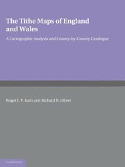

Du kanske också är intresserad av
The Enclosure Maps of England and Wales 1595-1918
Roger J. P. Kain, John Chapman, Richard R. Oliver
Häftad, 2011
1 169 kr
Del 6
An Atlas and Index of the Tithe Files of Mid-Nineteenth-Century England and Wales
Roger J. P. Kain
Häftad, 2011
1 079 kr
Selected Works of Miguel de Unamuno, Volume 6
Miguel de Unamuno, Anthony Kerrigan, Martin Nozick
Inbunden, 2017
5 109 kr
Del 1
Advancing Precision Agriculture With AI and IoT
Rashid Abbas Khan, Vishnu D Rajput, Asghari Bano
Inbunden, 2026
5 109 kr