
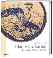
Islamic Maps
Inbunden, Engelska, 2019
639 kr
Beställningsvara. Skickas inom 5-8 vardagar. Fri frakt för medlemmar vid köp för minst 249 kr.
Spanning the Islamic world, from ninth-century Baghdad to nineteenth-century Iran, this book tells the story of the key Muslim map-makers and the art of Islamic cartography. Muslims were uniquely placed to explore the edges of the inhabited world and their maps stretched from Isfahan to Palermo, from Istanbul to Cairo and Aden. Over a similar period, Muslim artists developed distinctive styles, often based on geometrical patterns and calligraphy. Map-makers, including al-Khwārazmī and al-Idrīsī, combined novel cartographical techniques with art, science and geographical knowledge. The results could be aesthetically stunning and mathematically sophisticated, politically charged as well as a celebration of human diversity. 'Islamic Maps' examines Islamic visual interpretations of the world in their historical context, through the lives of the map-makers themselves. What was the purpose of their maps, what choices did they make and what was the argument they were trying to convey? Lavishly illustrated with stunning manuscripts, beautiful instruments and Qibla charts, this book shows how maps constructed by Muslim map-makers capture the many dimensions of Islamic civilisation, providing a window into the worldviews of Islamic societies.
Produktinformation
- Utgivningsdatum2019-10-18
- Mått237 x 280 x 18 mm
- Vikt1 334 g
- FormatInbunden
- SpråkEngelska
- Antal sidor192
- FörlagBodleian Library
- ISBN9781851244928
Tillhör följande kategorier
Hoppa över listan

Mer från samma författare
Marriage, Money and Divorce in Medieval Islamic Society
Yossef Rapoport, David Morgan
Inbunden, 2005
949 kr
Del 10
Book of Clear Arabic Expression regarding the Arab Tribes of Egypt
Yossef Rapoport
Inbunden, 2024
2 229 kr
Empires of Faith
Raina Abouzeid, Jon B. Alterman, Ali M. Ansari, James Barr, Ali Fathollah-Nejad, Peter Frankopan, Chaim Gans, Amber Gartrell, Kim Ghattas, Andrew S. Gilmour, Martin Goodman, Sir John Jenkins, Halil M. Karaveli, Hugh Kennedy, Stephen Kotkin, Nelly Lahoud, Göran Larsson, Gabriel Martinez-Gros, Sir Simon Mayall, Yossef Rapoport, Mark Ronan, Stefanie Rudolf, Peter Sarris, Nathan Shachar, Brendan Simms, Selena Wisnom
Inbunden, 2026
299 kr
Hoppa över listan

Du kanske också är intresserad av
Marriage, Money and Divorce in Medieval Islamic Society
Yossef Rapoport, David Morgan
Inbunden, 2005
949 kr
Empires of Faith
Raina Abouzeid, Jon B. Alterman, Ali M. Ansari, James Barr, Ali Fathollah-Nejad, Peter Frankopan, Chaim Gans, Amber Gartrell, Kim Ghattas, Andrew S. Gilmour, Martin Goodman, Sir John Jenkins, Halil M. Karaveli, Hugh Kennedy, Stephen Kotkin, Nelly Lahoud, Göran Larsson, Gabriel Martinez-Gros, Sir Simon Mayall, Yossef Rapoport, Mark Ronan, Stefanie Rudolf, Peter Sarris, Nathan Shachar, Brendan Simms, Selena Wisnom
Inbunden, 2026
299 kr
Del 10
Book of Clear Arabic Expression regarding the Arab Tribes of Egypt
Yossef Rapoport
Inbunden, 2024
2 229 kr
- Nyhet
Del 3